
Flood resilience assessment and possible solutions to decrease flood vulnerability of a city
Floods are one of the most destructive natural hazards in the world. They cannot be prevented but their impacts can be minimized. Changes in climate and urbanization increase the severity and frequency of flood events in Turkey.
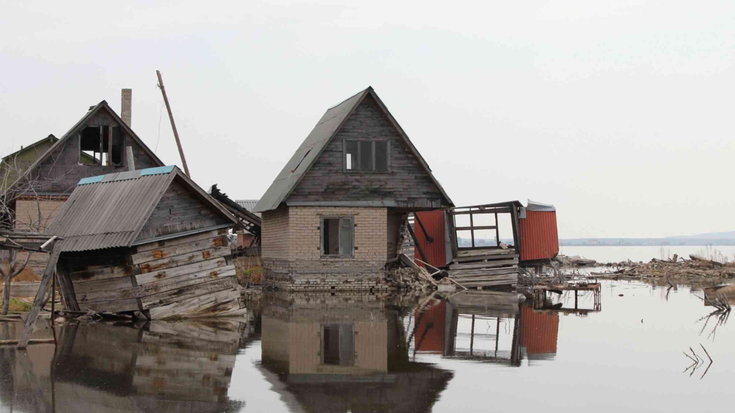
Mersin is selected as a case study in this article because the frequency of floods has increased in the last years. Furthermore, population has also increased very fast recently because of refugees. In Turkey, flood management plans of river basins have been prepared by private companies under the control of General Directorate of Water Management. These plans are very detailed. Flood inundation maps, flood hazard maps and flood risk maps are prepared, and measures are proposed to decrease the impacts of floods. However, impacts of climate and urbanization changes are not considered in these plans.
Furthermore, proposed measures are not sustainable and most of them are structural measures. The major problem is the collection of data. Historical flood data is crucial to understand the main problems related with flood hazard. However, historical flood data is very limited in Turkey. Hence, monitoring and evaluation mechanism must be developed to collect necessary data. For example, depth-damage curves, that must be spatial, of the different countries are used while generating flood risk maps in Turkey.
For this reason, generating flood risk maps and calculating economic damages are problematic. The other problem is that the calibration and validation of hydrological and hydraulic models. Calibration and validation are important steps to generate models which reflects real world’s conditions. Hydrological models are mostly calibrated and validated properly. On the other hand, this is not the situation for hydraulic models. Flood maps can be generated easily using one of the hydraulic models but the calibration and validation of it is very crucial.
Several flood maps exist in Mersin, but they cannot be calibrated and validated because of non-existence of historical flood information. Some Sustainable Development Goals (SDGs) and Sendai Framework for Disaster Risk Reduction (SFDRR) will be considered while developing action plans. These are: 3rd SDG (ensure healthy lives and promote well-being for all at all ages), 6th SDG (ensure availability and sustainable management of water and sanitation for all), 8th SDG (promote sustained, inclusive and sustainable economic growth, full and productive employment and decent work for all), 10th SDG (reduce inequality within and among countries), 11th SDG (make cities and human settlements inclusive, safe, resilient and sustainable) and 13th SDG (take urgent action to combat climate change and impacts).
Reducing global disaster mortality, reducing the number of affected people, reducing direct disaster economic loss in relation to GDP, reducing disaster damage to critical infrastructure and disruption of basic services and increasing the availability of and access to multi hazard early warning systems and disaster risk information and assessments to people are the SFDRRs that will be considered while developing action plans.
City Water Resilient Approach (CWRA) that is prepared by the Rockefeller Foundation, The Resilience Shift, ARUP and SIWI in 2019 is used in urban resilience and risk assessment of Mersin because it helps to create a complete framework for water resilience assessment. CWRA helps to understand the system, identify the problems, and develop solutions. It is a multi-step process that moves from understanding the system, through urban water resilience assessment, to the creation and implementation of an action plan, and the monitoring the results of interventions (the Rockefeller Foundation et al., 2019).
First and second steps will be conducted at this stage. In the first step, the system will be analysed. There are two institutions in Turkey which are responsible from flood related works. One of them is responsible for construction works, design projects etc. while the other one is responsible for the preparation of flood management plans. One problem is lack of communication between these two institutions.
Another problem is that there is no up-to-date flood law. Legal and institutional frameworks, mechanisms and policies are also not strong enough. For example, when urban planners ask for an opinion about flood situation to the relevant institution, the opinions that they get are either inadequate or not systematic. Water-sensitive urban development is barely promoted. Furthermore, improvement of water performance for buildings is rarely considered in design process and sustainable infrastructure is not adapted.
Another problem is about the flood maps. There are some flood maps that were generated. As it is mentioned before, they cannot be validated because of the lack of information. Lack of information might cause underestimation or overestimation of the flooded areas. Climate change and urbanization effects are also not considered in these maps. The final problem is related to monitoring of infrastructures and floods and modelling of floods. Flood maps for Mersin mostly belong to fluvial floods. Pluvial floods and coastal floods are not analysed and modelled in detail.
In the second step, flood resilience system is assessed, and this can be done through workshops because it is important to take all stakeholders’ opinions. CWRF can be used to calculate the scores. The resilience of the city is very low, and some actions must be taken to make the city resilient. The highest score belongs to equitable provision of essential services, but it is only average. The scores are (out of 5) 1.75 for empowered community, 1.8 for strategic vision, 1.67 for coordinated basin governance, 1.6 for effective regulation and accountability, 1.5 for adaptive and integrated planning, 1.33 for sustainable flooding and finance, 1.8 for effective disaster response and recovery, 2.2 for effective asset management, 2.1 for protected natural environments, 3 for equitable provision of essential services, 2 for healthy urban spaces and 2.25 for prosperous communities. Vulnerable aspects of the city in terms of water can be clearly seen from this assessment.
In the third step of CWRA, action plan(s) are developed. Social, economic, and environmental impacts of the plan(s) are assessed. Problems related to flood are introduced in previous paragraph. Some improvements are required to increase the resilience of the city. All possible positive impacts and negative impacts of plan(s) can be seen by “Pathways” (Ramboll & C40 Cities, 2018). It is widely used to identify all possible positive impacts and negative impacts of an intervention when conducting an impact analysis and policy evaluation.
First thing to do is to strengthen the communication between the institutions. This is very important because it will save money and time. There are some studies which were conducted by different institutions for the same city. Furthermore, the strengthened communication between institutions will be the base of systematic approach for the flood problem. Strengthening the communication will be helpful to achieve 6th, 8th and 11th SDGs and previously mentioned SDFRRs.
Another improvement that should be done as soon as possible is to strengthen legal and institutional frameworks, mechanisms, and policies. If the water resilience of the city is wanted to be increased, a systematic approach should be developed that includes legal frameworks, mechanisms, policies, and flood related laws. Furthermore, this approach should be developed considering all stakeholders. This improvement will contribute in achievement of all SDGs and SDFRRs. Incorporating technical and expert knowledge into decision making processes is another improvement that should be considered. Multicriteria decision making tools or agent-based modelling might be used to develop solutions for water infrastructure.
Taking opinion of the community is also very important while developing solutions. Social, economic, and environmental impacts of the solutions must also be taken into account. Final decision (why this action plan is selected, advantages and disadvantages, social, economic, and environmental impacts etc.) must be explained transparently to all stakeholders. Long-term conditions should be also considered while developing action plans. Climate change impacts and urbanization impacts must be considered in the analysis. Flood analysis must be done based on different scenarios to see what the results of the action plans might be.
This is the most critical part because if these changes are not considered, even if the action plan is successful for short term, it might be worthless for long term because climate is changing, and urbanization is increasing. Hence, the severity and frequency of the floods change due to climate and urbanization changes.
Water resilience must be promoted by the government. This improvement is very important for achieving the 13th SDG. It will also contribute to SDFRRs and other SDGs. Another improvement that should be done is to enforce land use regulations and zoning. Flood maps must be generated for whole city to develop land use regulations and zones. Different classifications (low, medium, high risk etc.) might be calculated using flood maps and land use planning must be done considering this classification. Water must be one of the key elements in land-use planning. Design guidelines and construction standards for flood control structures should be clearly defined to maintain the sustainability of the structures.
Application of water sensitive design principles to buildings in flood vulnerable areas is of vital importance. Furthermore, these guidelines and standards must promote the water resilience. Another improvement that must be done as soon as possible is to establish a systematic hazard monitoring and evaluation system. Monitoring flood events is essential to learn lessons from the events. However, there is not a well-established system here. For example, detailed information is collected for some flood events while the data of some events is not collected. Economic, environmental, social, and technical aspects of all flood events must be evaluated and collected. Some questionnaires might be generated to collect same information from all flood events.
Another improvement that might be done is to establish a forecast and early warning system. Floods are natural hazards and they cannot be prevented but they can be forecasted and if an early warning system is established, people could be warned earlier, and the impacts of floods might be minimized. After establishment of the system, community must be informed about the system and community based early warning system must be promoted.
Green and blue infrastructure should be adopted to make the city more resilient. Developing solutions that minimize flood impacts is important, but it is not adequate. These solutions must be also sustainable and environment friendly. If these improvements are made, previously mentioned SDGs and SFDRR targets would be all achieved. This will make the city more resilient in terms of floods and decrease the flood vulnerability of the city.
If the water resilience of the city has to be increased, all stakeholders must work together. There are two institutions in Turkey which are responsible from flood related works. One of them is the General Directorate of State Hydraulic Works and the other one is General Directorate of Water Management. Participation of these two institutions is essential to implement urban resilience strategy.
In addition to these two institutions, municipality must also be one of the stakeholders. These institutions must first establish a systematic hazard monitoring and evaluation system and collect all necessary data. They should work on a legal framework and flood related law. City planners must be one of the stakeholders too. They should develop a system for land use planning that promotes water-sensitive urban land development. Architects and civil engineers from related institution are the other stakeholders that should participate. They should work together while determining water design guidelines and construction standards.
Insurance companies are another stakeholder. They should work on strengthened flood insurance system and the government must promote this system. It should promote the community to insure their homes against floods. Flood experts from universities should also participate in these studies. They can analyse international practices and contribute all policies, regulations etc. The community is the last stakeholder that should participate. They should also state their opinions because they are affected most in a flood situation.
References:
- City Water Resilience Assessment. Retrieved from https://www.arup.com/perspectives/publications/research/section/the-city-water-resilience-approach
- Sendai Framework for Disaster Risk Reduction 2015-2030. Retrieved from https://www.preventionweb.net/files/43291_sendaiframeworkfordrren.pdf
- Sustainable Development Goals. Retrieved from https://sdgs.un.org/goals
Urban Climate Action Impacts Framework. Retrieved from https://c40-production-images.s3.amazonaws.com/other_uploads/images/1605_C40_UCAIF_report_V3.original.pdf?1518203136
Murat Yeğin is a PhD student and research assistant in Water Resources Laboratory of Civil Engineering Department at Middle East Technical University.
The views and opinions expressed in this blog are those of the author and do not necessarily reflect those of the Coalition for Disaster Resilient Infrastructure (CDRI)